Full Arabic support
All geographic labels available in Arabic and English with instant toggle.
An open-source interactive project displaying the world in polar AEQD projection
Flat Earth Map is an interactive web application that displays the world using the Azimuthal Equidistant Projection (AEQD) — a geographic projection that preserves true distances from a center point to any location on the map, and is used in aviation navigation, GPS systems, and the United Nations emblem.
The project is built entirely with open-source technologies, aiming to deliver a professional mapping experience with full Arabic language support, including comprehensive information layers: continents, countries, provinces, cities, seas, rivers, and mountains.
In Flat Earth Map, the AEQD (Azimuthal Equidistant) projection is centered on the North Pole at the middle of the map, so the continents fan out around it in a circular layout. Its strength is preserving true distances and directions from the center point to any location, which is why it is used in aviation navigation and the United Nations emblem.
To read the map: the center is the North Pole, and the closer you move toward the edge, the closer you get to the southern hemisphere. You can zoom in and out, rotate the map to any angle you like, and click any region to highlight its borders, while switching all labels between Arabic and English with one tap.
Read the full guide to the Flat Earth Map & AEQD projection →
We aim to build an integrated mapping platform that serves both Arabic and international users with standards that compete with major service providers, while maintaining our unique identity in displaying the world through AEQD projection.
All geographic labels available in Arabic and English with instant toggle.
Source code is available to everyone, and anyone can contribute or deploy it.
Mapbox Vector Tiles (MVT) for fast and smooth layer loading.
Click any region to highlight its borders and view its details instantly.
This is an open-source volunteer project, and we welcome anyone who wishes to contribute. We are currently looking for:
JavaScript, OpenLayers, ES6 Modules
Python, Flask, APIs, Cloud Storage
Geographic projections, GeoJSON, MVT
Interface design, user experience, prototypes
Translating geographic names, content review
Writing guides, technical docs, educational content
Your support helps us cover server costs and continuous development. Every contribution, no matter the size, makes a difference.
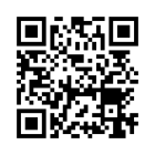
TFqVZKdxUUbdPzjG6UtZejgFWrjTBoikbr
It is a free interactive map that displays the world — continents, countries, cities, seas, and rivers — using the polar AEQD projection, with full Arabic and English support, and it is open source.
AEQD (Azimuthal Equidistant) is a geographic projection that preserves true distances and directions from a center point to the rest of the map. Its polar form, centered on the North Pole, is popularly known as the flat earth map, and it is the same one used in the United Nations emblem.
Yes, the map is completely free and open source, and anyone can use it or contribute to its development.
Geographic labels are available in Arabic and English, with an instant toggle that switches all names and interface elements.
Layers include: continents, countries, provinces, cities, seas and oceans, rivers, lakes, and mountains with their peaks, revealed progressively as you zoom in.